Free Ocean Conditions App for the Salish Sea
A new tool for marine forecasting and real-time conditions offers a high resolution look at currents, waves, tides, and more in the Salish Sea.
This post was originally published as a guest piece in Hakai Magazine’s newsletter. Sign up here to receive this free weekly newsletter.
I’ve been exploring the waters around Vancouver Island since I first came to British Columbia 20 years ago from the landlocked plains of Manitoba. When I started sailing, the marine weather forecast arrived via a robotic voice on a crackly handheld VHF radio. The nautical charts I relied on for navigating were large, creased papers that I had photocopied from the library and laminated with packing tape. Mold eventually ate them.
Today’s plethora of weather apps provides comprehensive data on tides and wind, and digital charts make navigation easier. But there has always been a missing puzzle piece when it comes to understanding ocean conditions: a reliable forecaster of ocean currents.
I work as part of a software development group at the Pacific branch of the Canadian Integrated Ocean Observing System—better known as CIOOS Pacific—a collaboration between the Canadian government and several universities and nonprofits, such as the Hakai Institute. Last fall, my boss forwarded our team a demo of a high-resolution map of currents based on a model created by an oceanography research team at the University of British Columbia (UBC). We embarked on an exciting project to create an app that presents UBC’s ocean current forecasting data to the public in an accessible way.
Our end product, OceanConnect, offers ocean enthusiasts a view of the Salish Sea—the stretch of Pacific waters straddling the border between British Columbia and Washington State—that they’ve never had before. Unlike other forecasters, OceanConnect provides a map of currents up to 40 hours into the future, high-resolution data for sea temperatures, and standard information for air temperatures, wind, waves, and tides. Think Windy, but with a fine-scale focus on ocean conditions. It’s that UBC-based model that really sets it apart—it provides the only accurate map of ocean currents for this notoriously complicated coastline.
Of course, as a responsible sailor, I had to test the team’s creation before the public launch of OceanConnect. A friend and I took a small catamaran on a 40-kilometer trip from Sidney Island to Mayne Island, both in British Columbia, to attend a music festival this past June. I promised my friend we would be there before dark. Most often, it’s impossible to time a trip on a boat with no motor, and on the last leg of the sailing journey, a prevailing northwest wind blocked a narrow waterway that lay between us and our destination. But OceanConnect forecasted that the currents and wind would be in our favor. When we reached the final passage, the currents sucked us in and spat us out at the festival—success!

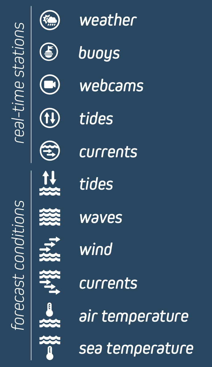
OceanConnect brings together the best available models on current and future ocean conditions in the Salish Sea. The above image shows the variables included in the app, while the video demonstrates some of its functionality—in particular, the high-resolution forecast for currents, which is especially valuable along the complex coastline in the Salish Sea.
If you’re in the Salish Sea region and have a chance to try it out, let us know if you have any feedback at OceanConnect.ca. And if you live anywhere else in coastal British Columbia, we plan to serve you soon.

