Getting to Know a Landslide
A team of experts investigates the aftermath of the Elliot Creek landslide from all angles.

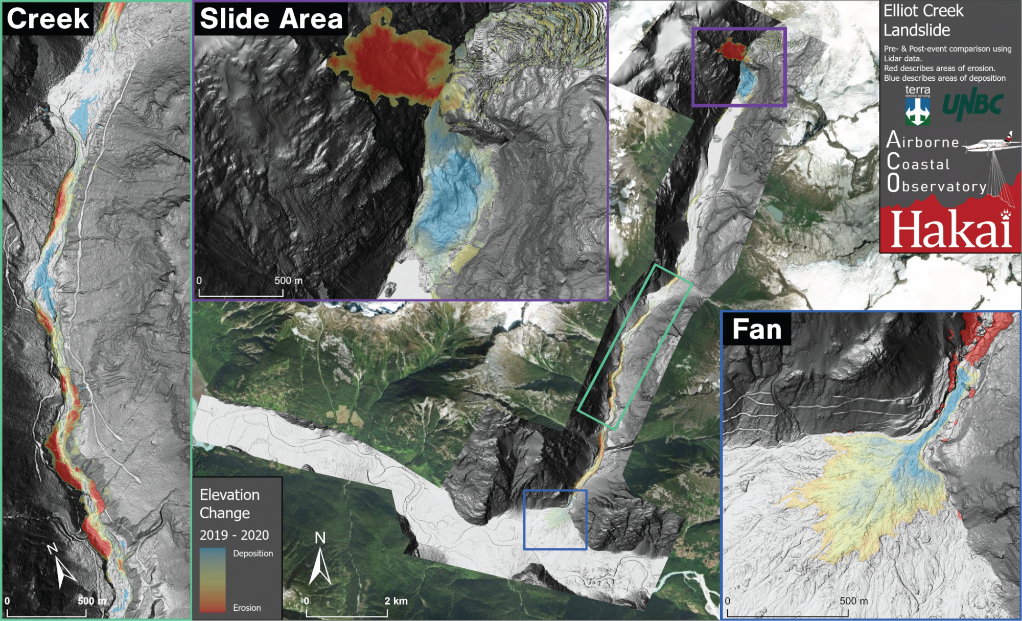
When a landslide strikes, scientists search for landscape clues to decipher what happened. They may have an overall general sense of what an area looked like pre-slide. But re-creating the catastrophic event with a dearth of details is like trying to figure out how a building collapsed using only a distant photo of the facade and another of the rubble aftermath. The massive Elliot Creek landslide that occurred in British Columbia’s Coast Mountains in late 2020 was an exception. At Elliot Creek, scientists have the original architectural blueprints.
“We’re incredibly fortunate that we had a preexisting map of the area,” says Derek Heathfield, a geospatial scientist with the Hakai Institute, part of a keen team of dozens of researchers from multiple institutions studying the aftermath of the slide.
This preexisting map was produced largely by chance while monitoring changes to the adjacent Homathko Icefield using the Airborne Coastal Observatory (ACO). Additional data collected during these ACO flights simultaneously produced the critical “before” landscape around Elliot Creek—a piece of the geological puzzle that’s rarely available. By comparing the previously collected landscape data with maps produced after the slide, scientists can calculate how much material fell off the mountainside and exactly where it ended up.

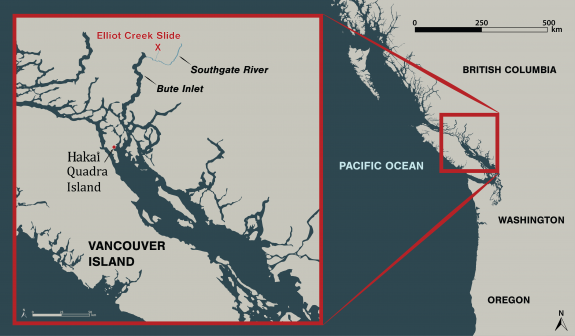
Detailed maps are only the beginning. The aftermath of the landslide will be analyzed throughout the watershed, from the source at the glacier to the outflow in the Southgate River and Bute Inlet.
“It’s a super destructive event that thankfully didn’t kill or hurt people directly,” says Ian Giesbrecht, a scientist with the Hakai Institute, “but it does indirectly affect people in significant ways.”
Giesbrecht and others are working closely with the Homalco First Nation, whose territory covers the area of the slide where important fish habitat was destroyed. In addition to mapping geological change, the collaborative team will be tracking how the landscape recovers ecologically, especially with regard to salmon stocks.
“The slide caused a huge spike in turbidity in the Southgate River,” says Giesbrecht, whose team measured levels of turbidity more in line with the spring glacial melt, and 32 times what they’d expect to see in the river during wintertime. “The long-term impact on salmon and other species isn’t known yet, but it’s not likely to be positive.”
Then, it’s the oceanographers turn as they follow water through the Southgate River into Bute Inlet. After the slide, a flush of dense cold water entered the inlet and sank below the layer of warmer ocean water. Oceanographers have already noted a considerable shift in deep water temperature, bringing the conditions closer to expected after years of unprecedented warm conditions. And another team, led by scientists from England, is tracking where carbon and sediment from the slide settled in the inlet on the seafloor.
As for what caused the slide, the answer is both apparent and simultaneously unknowable.
Aerial view of the area where Elliot Creek meets the Southgate River before and after the landslide event in November 2020. Satellite pre-slide image from Bing. Post-slide image by the Airborne Coastal Observatory and Terra Remote Sensing
“It’s clear that climate change is setting the stage for these things to occur,” says Brian Menounos, a professor of glaciology at the University of Northern British Columbia. “As glaciers retreat, they expose steep, unstable slopes that can fail without warning.”
In the case of Elliot Creek, the landslide suddenly entered a lake at the base of the glacier, displacing a large amount of water to the valley below and causing what’s known as a glacier outburst flood.
LiDAR-derived terrain model of before (left) and after (right) the Elliot Creek landslide where it entered a lake at the base of a glacier and caused what is known as a glacier outburst flood. Maps by the Airborne Coastal Observatory
As for the exact cause of the Elliot Creek landslide itself, Menounos says, “we may never know the straw that broke the camel’s back, but why was its back ready to break in the first place? Retreating glaciers likely contributed to this event.”
Stay tuned for more media as we continue to learn more about this landslide, and what it can tell us about the potential for similar events along the coast of British Columbia and beyond.

